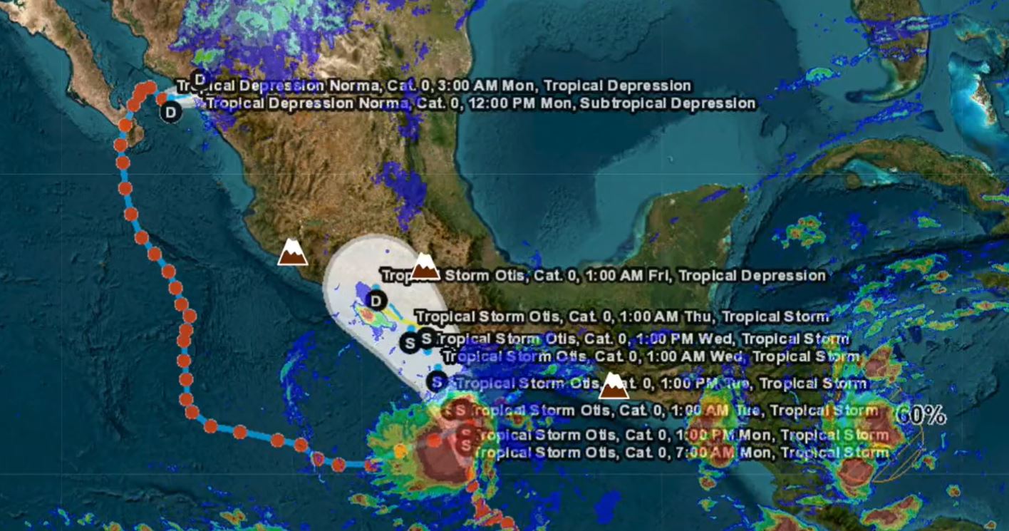
(CNN Spanish) — Tropical Storm Otis is moving towards Mexico and is threatening heavy rain in parts of the southwest and south of the country, according to a report from Mexico’s National Meteorological Service (SMN) at 9:30 pm (local time).
What will Otis study this week?
At the time, Otis was located about 265 kilometers south-southwest of Oaxaca and 425 kilometers south-southeast of Acapulco, with maximum sustained winds of 85 km/h, gusts of up to 100 km/h, according to the report. and moving north-northwest at a speed of 11 kmph.
According to the latest update from the US National Hurricane Center (NHC), Tropical Storm Otis is expected to strengthen this Tuesday and reach or approach hurricane strength when it makes landfall near Acapulco in southern Mexico on Wednesday morning. .
Otis Career Forecast. Courtesy: SMN of Mexico
Areas affected by tropical storm Otis
The forecast indicates a rain warning for the south and southeast of Mexico, with the highest incidence in Guerrero, Oaxaca and Chiapas. The SMN established a “monitoring zone for the effects of the tropical storm from Técpan de Galeana, Guerrero, to Lagunas de Chacahua, Oaxaca.”
The US National Hurricane Center (NHC) has warned Possible flash floods and landslides From high ground.
Officials are urging residents and boaters to take extreme precautions against the risk of storm surge, strong winds and waves. In addition, they call for the recommendations of the National Civil Defense Organization to be followed in each region.


:format(jpeg)/cloudfront-us-east-1.images.arcpublishing.com/gfrmedia/ZQRHYKU4PZET7HCT6ECILFGM5U.jpg)

:quality(85)/cloudfront-us-east-1.images.arcpublishing.com/infobae/D2UJSBCUXREFNHSQPIUZ5CGTJQ.jpg)