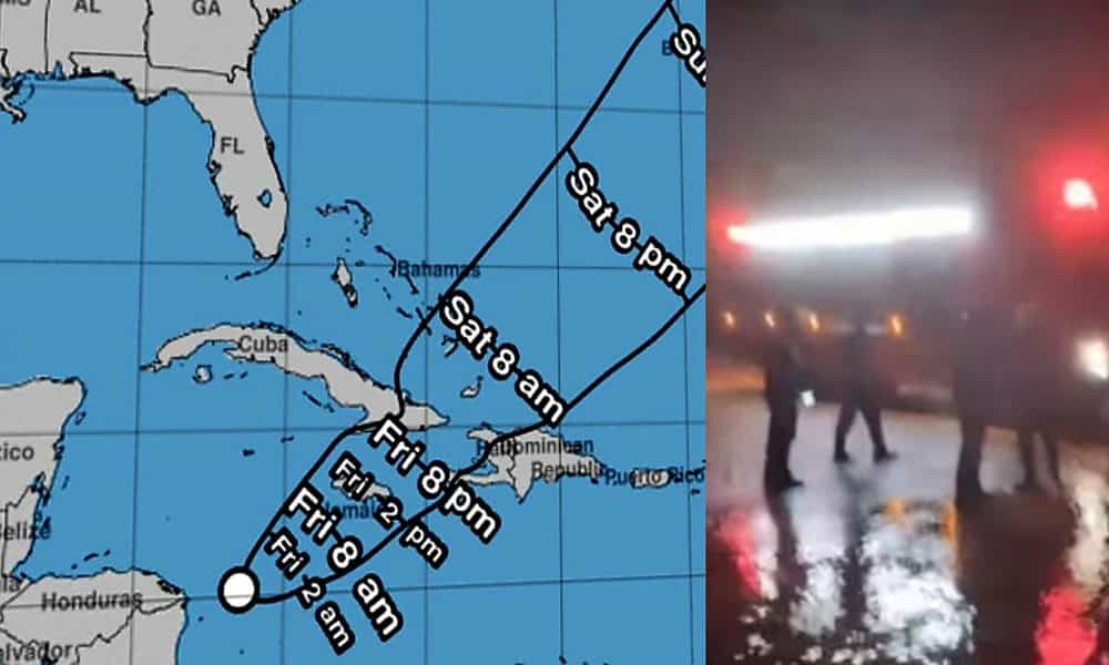
In Cuba, the National Civil Defense General Staff decreed this Thursday a state of alert for the eastern provinces due to heavy rains. These are the territories of Guantanamo, Santiago de Cuba, Holguin, Granma and Las Dunas. According to the Cuban system, an extensive area of cloudy weather with rain, showers and thunderstorms is well organized in the Caribbean Sea.
Hence, there is a probability of formation of a low pressure area in the next 24 to 48 hours, which may convert into a tropical depression.
Similarly, the National Hurricane Center (NHC) of the United States has also announced that a low pressure system is forming this Thursday. In Potential Tropical Cyclone Warning No. 1, it warned that the disturbance located in the western Caribbean Sea could become a tropical storm.
Meanwhile, the Cuban Meteorological Institute (INSMET) predicted heavy rains in eastern Cuba in a report issued at 4:00 p.m.
INSMET said in its special notification no. Mentioned in 1. All this, regardless of the future development of the low pressure zone in the Caribbean Sea.
It is to be noted that heavy rain is likely at some places during the next morning and will intensify.
He also informed that between 11 am and 1 pm on this Thursday, there has been a considerable amount of rain.
We are talking about the 51 millimeters of rain recorded at the meteorological station in Cabo Cruz, Granma. This panorama is associated with a trough and moist flow east of Cuba from the low pressure area of the Caribbean Sea.
What to do in the presence of these weather phenomena?
In addition, INSMET added several recommendations based on the predicted intensity of rainfall and the hydrological situation associated with the rainfall. Attention and caution are essential in this climate.
Finally, it is recommended that the public be kept informed about the evolution of the system through national media and official profiles.


