VILA-REAL. Vila-real plans a drafting landscape and environmental action to enhance the banks of the Millars with the creation of a river park and an urban park with which the municipality will triple the current green area around the river. The project Connection Millars Villarreal XXI century In which the Mayor’s Office and Territory departments work, it contemplates the protection of more than 126,000 square meters of green space, divided into a river area parallel to the Millars in the area of Molí Nou – between the Santa Quiteria bridge and the N bridge. -340- and an urban park in the Madrigal area and Encarnación street.
The Councilor for Territory, Emilio M. Obiol, has underlined the relevance of a project that represents the most important environmental action in the city in the last century since the current Termet area was born in February 1924 with the planting of 3,000 trees.
The project Connection Millars Villarreal XXI century It has been designed as an urban and environmental intervention made up of two elements: a river park parallel to the river between the Santa Quiteria bridge and the N-340 bridge, and an urban park that will be located in the area adjacent to Millars (parallel to Calle Encarnación) in which the City Council recently suspended licenses to qualify as a green area.
Obiol recalls that “the lands that will be assigned for the construction of the fourth institute, located in the Madrigal area, near the José Soriano school, are classified in the General Urban Planning Plan as a green area.” “By requalifying this land as educational endowment, it is necessary to relocate these square meters of green area at another point”, details the councilor, who adds that “our proposal is to create a large urban park in an area of more than 20,000 square meters in the around Encarnación street, which would be complemented by another 7,500 square meters of green area next to the future fourth institute ”, which will be located a few meters away. This will result in an urban park, made up of several spaces located around the Millars, with a total area of 27,961 square meters.
It will occupy an area of 98,262 square meters
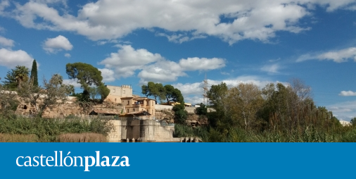
The river park will occupy an area of 98,262 square meters, divided into two sections. The first of them, between the Santa Quiteria bridge and the Almassora-Castellón weir, will allow us to contemplate the sheet of water of the river, which at this point runs continuously. In the second, between the weir and the bridge of the N-340, the sheet of the river is discontinuous, but outstanding elements of the city’s hydraulic heritage are preserved, such as the Molí Nou de Santa Sofía and the Els Corrents weir, which dates from from the 17th century, as Obiol recalls. The environmental and landscape intervention to create the riverside walk along the river is designed to be executed in two phases.
In sum, ‘Millars Vila-real XXI Century Connection’ will mean the creation of a green area in the area of Millars of 126,224 square meters, so that, when the project is completed, the city will triple the current surface of the Termet (76,917 square meters ). Obiol has remarked that the government team intends to submit this urban proposal to public debate and citizen participation so that “between all of us, we can make possible this great project that will undoubtedly mark a before and after in the connection between the city and the Millars river ”.


